Welcome to the Encyclopedia of Saskatchewan. For assistance in exploring this site, please click here.
The ecoregion concept grew from the realization that Conservation and recognition of human effects on the natural world required that we think at the level of ecosystems and biological communities, rather than at the single species level. The earlier single species approach concentrated on Mammals and Birds, often recognizing other organisms only as prey, predator or nesting site. The present approach recognizes the complexity and interactions of the physical, as well as the biotic, aspects of the environment. Ecoregions are described by the basal physical features of the environment: geological structure and chemistry, the landforms which have developed on the geological underpinnings over time, and Climate. The interactions of these physical factors determine the development of the soil in which the plant and other producer or autotrophic organisms can live. Only after the autotrophs have become established can animal species, completely dependent on the producers for food and shelter, become a sustainable part of the community. The ecoregion concept also includes the effects of human actions on communities. Some ecoregions have been affected more than others; in Saskatchewan, the ecoregions within the Prairie Ecozone have been modified to a far greater extent than those of the Taiga Shield. As a result, some of the affected areas, especially where the ecosystem is vulnerable, have been declared Endangered Spaces, which need recognition and protection. Implicit within the concept is the realization that ecoregions will shift and change over time. Physical processes such as erosion and accumulation of water-borne materials will change watercourses. Long-term climate change, as well as short-term changes in weather patterns, will shift the position of plant communities. Warmer, drier climate will shift the ecoregions to the northeast; cooler, moister climate will shift them to the southwest.
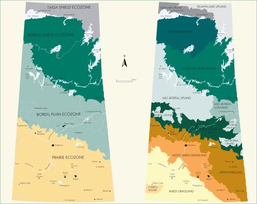
The ecoregion concept is hierarchical. It consists of three levels of communities. The first, or ecozone, level is the largest in scale. It is at the subcontinental level, describing extensive, major ecosystems and ignoring political boundaries. The ecozones have a northwest to southeast alignment across the province, reflecting the precipitation gradient. The ecoregion subdivisions of the ecozones constitute distinctive communities, set apart by climatic or landform factors. The ecodistrict subdivisions of the ecoregions reflect local differences in factors such as climate, soil, relief and water availability, which result in distinctive vegetation. The more southerly ecoregions have more ecodistricts, in relation to the more finely developed drainage systems. Saskatchewan is part of four ecozones: the Taiga Shield, the Boreal Shield, the Boreal Plain, and the Prairie. These are all extensive, being found in a number of contiguous provinces and states. They are divided into eleven ecoregions, ranging from two to four within a zone (see Figure ECO-1 on page 272).
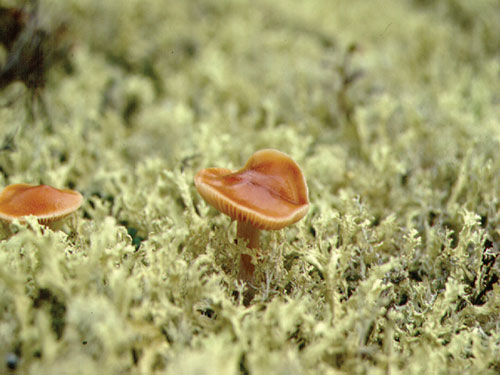
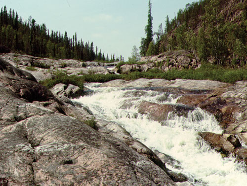
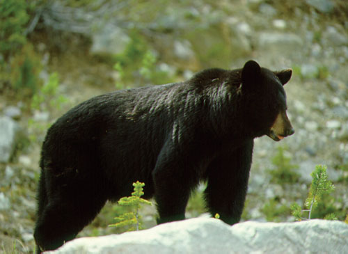
Taiga Shield: Underlain by the crystalline rocks of the Precambrian Shield, with poor soil development, covered in areas by glacial drift, in low relief, this is the northernmost ecozone of the province. The poor drainage and rolling post-glacial topography result in numerous lakes, including Lake Athabasca. The long, very cold winters and low precipitation limit the vegetation to lichen woodlands on higher elevations, and bogs in the lowlands. The limited vegetation results in a low number of animal species—the lowest of any ecozone in the province. This is the only area in the province in which arctic and subarctic species such as the arctic fox, caribou, and rock ptarmigan predominate. The human population of the region has apparently always been low. There is virtually no agriculture possible, but mineral exploration and exploitation have had some effect.
Selwyn Lake Upland: This ecoregion is found in the extreme northeast. The relief is low, and the landscape is dominated by moraines and till plains. The area is drained by the Churchill and Nelson rivers. The ecodistricts, differing in soil development, relief, and plant cover are: Dunvegan Lake Upland, Eynard Lake Upland, Robins Lake Upland, Striding River Upland, Nueltin Lake Plain, and Seale River Plain.
Tazin Lake Upland: An area of higher relief than the Selwyn Lake Uplands, where moraines are less well developed and the surface is often bare rock outcrops. There are black spruce-jack pine Forests with a more specious vegetation, reflecting the somewhat less harsh climate. The ecodistricts, differing in relief and soil development, are: Uranium City Upland and Territories Upland.
Boreal Shield: This largest ecozone, which at 18.7 million hectares comprises nearly one-third of the province, is a region of extensive boreal forest lying on the Canadian Shield. Bedrock alternates with glacial tills; as in the Taiga, Glaciation resulted in a rolling topography containing numerous lakes of various sizes. The climax vegetation of much of the region is dense black spruce with moss ground cover. In more protected and open areas, there are birch and trembling and balsam poplar, as well as jack pine and tamarack. This more diverse vegetation supports a larger fauna than further north. Several species of the deer family as well as a number of Carnivores such as wolf, marten and mink, are residents. Bird such as ravens, barred Owls and boreal Chickadees are also to be found, while a large number of insectivorous birds are summer residents, raising their young on the numerous insects of the short summer. This region has been the site of extensive Mining.
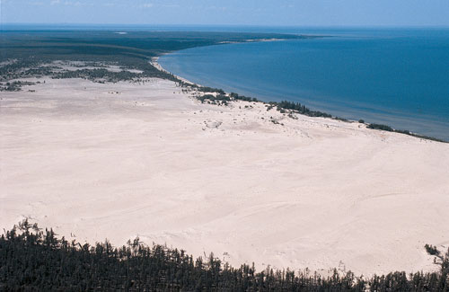
Athabasca Plain: This ecoregion is on sandstone bedrock along the Alberta border, south of Lake Athabasca and east to Wollaston Lake. The landscape is a patchwork of glacial and waterborne deposition, with moraines, eskers and sand dunes resulting from erosion of the underlying sandstone. The ecodistricts are: Athabasca Dunes, Carswell Plain, McTaggert Plain, MacFarlane Upland, Livingstone Plain, Squirrel Lake Plain, Fond du Lac Lowland, Lower Cree River Plain, Pasfield Lake Plain, Pine River Plain, Cree Lake Upland, and Wheeler Upland.
Churchill River Upland: Based on Precambrian crystalline bedrock, this is the eastern section of the ecoregion. It is the largest single ecoregion of the province; at 11.3 million hectares, it comprises 17% of the province. The area has a thinner glacial deposit and less soil development than the softer rock of the Athabasca Plain. The lack of erosion materials leads to the clear water of the lakes and their lower productivity. The ecodistricts are: Black Birch Plain, Frobisher Plain, Pinehouse Plain, Foster Upland, Highrock Lake Plain, Wollaston Lake Plain, Reindeer Lake Plain, Macoun Lake Plain, Sisipuk Plain, Flinflon Plain, and Reed Lake Plain.
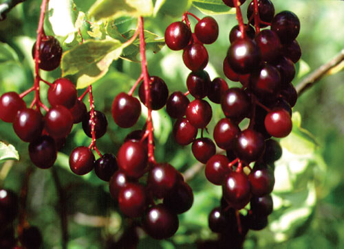
Boreal Plain: The Boreal Plain is an area of rolling plain based on sedimentary rock and covered by thick glacial deposits, interspersed by lakes and glacial kettles. The warmer climate of the ecozone, in relation to those further north, supports a greater variety of vegetation. The forest is mixed hardwood and coniferous species that include white and black spruce, jack pine, aspen, white birch, and balsam poplar. Lowlands near water may have American elm, green ash, and willows and sedges, along with a variety of Flowering Plants. More than fifty of the province’s seventy-two mammal species have been identified here, with most of the species in the southern areas of the zone; these include a number of carnivores which have been extirpated in the more heavily settled grasslands. Bird species richness is also high, with a number of migrants breeding in the area. Human activities in the region include forest-based hunting, fishing, trapping, and logging. Most of the pelts taken by trapping in the province are from this area. Approximately 16% of the land is devoted to agriculture, along the southern margins; this includes grain production, as well as the raising of livestock.
Mid-Boreal Upland: This region, consisting of rolling uplands and plains, is discontinuous. The main northwestern block is the largest single region of the zone. Other districts of this region lie to the south and east. Thirty ecodistricts have been delineated, ranging from the Firebag Hills in the northwest to Porcupine Hills and Duck Mountain in the east.
Mid-Boreal Lowland: This region is the lower-lying area of the region, along the Manitoba border. The low relief area is dominated by fens and peat bogs, with less wooded land. The ecodistricts are: Mossy River Plain, Namew Lake Upland, Saskatchewan Delta, and Overflowing River Lowland.
Boreal Transition: As noted by the name, this is an area of transition between the boreal forest and the southern grasslands. The gently rolling landscape is covered by a deciduous boreal forest with a higher percentage of trembling aspen, interspersed with native grassland species. In uncultivated areas, grasslands have been reduced with the suppression of the natural fires which once controlled the margins of the forest. Twenty-three ecodistricts have been named, based mainly on drainage patterns. These range from the Beaver River Plain, between the Beaver and Waterhen river drainages along the western border, to the Swan River Plain along the Assiniboine River.
Prairie: This is the Saskatchewan section of the great North American grasslands of the centre of the continent. The grasslands are separated from the boreal forest by a band of aspen parkland, with grasslands dotted by aspen bluffs. It is a zone of rolling plains with eroded uplands, with the Cypress Hills unglaciated uplands as a prominent feature in the southwest. Thick glacial deposits cover the surface, with development of the chernozemic Soils characteristic of grasslands. It is these soils which made the area so attractive to grain farmers. The thick glacial sediments and other features support the many aquifers of the zone. It has the most equable climate of the province, although there are still long, cold winters and short, often hot summers. The vegetation is mostly of grasses, with a number of flowering plants and shrubs found in the lower, moister areas. The wildlife species of the region are fewer in number; this is due partly to the specialized nature of the vegetation, with fewer Trees for nesting and shelter, and partly to a reduction of habitat and hunting by the larger human population. There are a number of grasslands specialist burrowers and runners, such as the Pronghorn, badger, ground squirrel, and burrowing owl. The Bison, once the dominant member of the natural ecosystem, has been to some extent replaced by domestic cattle, although these are not migratory and therefore do not have the same effects on the ecosystem.
The Prairie, being the predominant area of agricultural production, is the provincial ecozone most modified by human action. There is considerable activity to explore for, and extract, various non-renewable resources such as lignite, natural gas, and petroleum. Reservoir development, with attendant dams, has modified the precipitation-evaporation cycle, as well as the natural erosion-deposition which affects the natural changes in waterways. This is the most heavily settled area: over 80% of the province’s population lives in this zone. This combination of activities has resulted in the greatest amount of reduction of native vegetation. A number of protected areas, including the Grasslands National Park, have been developed by various conservation groups in an attempt to preserve what little native grasslands remain.
Aspen Parkland: This zone of transition between the aspen woodlands of the Boreal Transition and the prairie grasslands forms a band across the province, angling to the southeast. Aspen groves are found in the moister north-facing slopes and low-lying depressions, while fescue grasslands are found on the drier south-facing slopes and hillocks. There are twenty-two ecodistricts in the region, from the Lloydminster Plain in the west to the Oak Lake Plain in the east. They include Moose Mountain, an unglaciated upland with a remnant boreal forest ecosystem.
Moist Mixed Grassland: This ecoregion lies to the south of the Aspen Parkland band, echoing its angle across the province. It is drier than the parkland and consequently has fewer trees and shrubby vegetation, although they occur along stream courses and permanent sloughs. There are twenty ecodistricts in the region, ranging from the Neutral Hills in the west to the Souris River Plain in the east.
Mixed Grassland: The semiarid grasslands region is found in the southwest of the province. It is a dry grassland with a mixture of mid-grasses, such as wheatgrasses, and short-grasses, such as blue gramma. Because of the lower precipitation in the area, it has not been broken for agriculture to the same extent as the more humid Moist Mixed Grassland. There are twenty-five ecodistricts in the region, from the Kerrobert Plain, through the Great Sand Hills, to the Wild Horse Plain.
Cypress Upland: This unglaciated plateau, with the erosional dissection typical of an older landscape, is a very distinctive and easily recognized ecoregion. The higher elevation supports a forest associated with the montane forests further west, with lodgepole pine, white spruce and aspen. The bird fauna also reflects this, with western species such as Steller’s jay and MacGillivray’s warbler. There are only two ecodistricts, the Cypress Slope of moraine on the northern face of the hills, and the Cypress Hills themselves.
Diane Secoy
Print EntryHOME | BROWSE BY SUBJECT | ENTRY LIST (A-Z) | IMAGE INDEX | CONTRIBUTOR INDEX | ABOUT THE ENCYCLOPEDIA | SPONSORS TERMS OF USE | COPYRIGHT © 2006 CANADIAN PLAINS RESEARCH CENTER, UNIVERSITY OF REGINA | POWERED BY MERCURY CMS |
|||
| This web site was produced with financial assistance provided by Western Economic Diversification Canada and the Government of Saskatchewan. |
|||
| Ce site Web a été conçu grâce à l'aide financière de Diversification de l'économie de l'Ouest Canada et le gouvernement de la Saskatchewan. |
|||