Welcome to the Encyclopedia of Saskatchewan. For assistance in exploring this site, please click here.
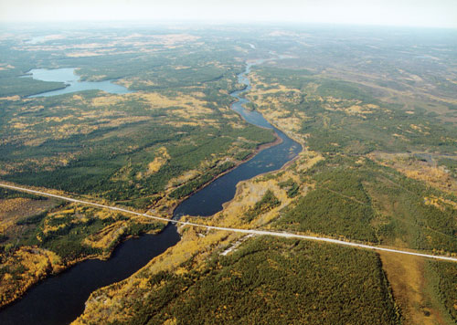
(56°42’ N, 110°00’ W; map sheet 74 D/9). Located in northwestern Saskatchewan, 50 km north of La Loche, the Clearwater River is exceptional in that it flows westward, joining the Athabasca River at Fort McMurray. En route the river carves its way through Precambrian and Phanerozoic rocks into a gradually deeper, cliff-lined valley with spectacular canyons of Devonian age dolomitic limestones. By the time it exits the province into Alberta, this river (187 km long) has displayed Class II to Class IV+ rapids and one breathtaking set of tightly knit waterfalls. A number of ancient pictographs or Aboriginal rock paintings along the water’s edge of the upper section of the Clearwater attest to the area’s pre-European occupation, which could be as old as 5,000 years. The river was also an important communication channel for Canada’s early Explorers and fur traders. The likes of David Thompson, Sir Alexander Mackenzie, Peter Pond, and Sir John Franklin all came across Methy Portage, a 19-km overland link on the Churchill-Clearwater-Athabasca route which ultimately linked Hudson Bay to the Arctic, allowing travelers to bypass the more difficult route across Precambrian rock formations further east. As early as 1778, Methy Portage provided the first major overland connection for what was to be the only route between east and west for almost forty years.
In 1986, the Clearwater earned a federal Canadian Heritage River System designation for its heritage and cultural significance. That same year, the provincial government turned most of the Saskatchewan portion into the 200,000-ha Clearwater River Wilderness Park. Visitors traveling by canoe or on foot can encounter a variety of rare plants, as well as animals such as bald eagles, black bear, moose, and many species of boreal songbirds and waterfowl. As the current takes travelers into the ancient glacial spillway, it assumes the shape of 30 m high gorges dominated by Trees and nesting raptors that bear witness to the impregnable quality of the river as an obstacle to land-based journeys. Some of the landscape features worthy of attention include Gould Rapids and the spectacular Smoothrock Falls, which even those traveling by raft must portage. Further west lies Skull Canyon, also known as Bald Eagle Gorge, where a towering island of rock splits the river into two dramatic channels that lead into a calmer and wider body of water. In the lower portion of the Clearwater, it is easier to discern the dimensions of the valley, which reaches 3 km in width and over 100 m in height.
Claude-Jean Harel
Print EntryHOME | BROWSE BY SUBJECT | ENTRY LIST (A-Z) | IMAGE INDEX | CONTRIBUTOR INDEX | ABOUT THE ENCYCLOPEDIA | SPONSORS TERMS OF USE | COPYRIGHT © 2006 CANADIAN PLAINS RESEARCH CENTER, UNIVERSITY OF REGINA | POWERED BY MERCURY CMS |
|||
| This web site was produced with financial assistance provided by Western Economic Diversification Canada and the Government of Saskatchewan. |
|||
| Ce site Web a été conçu grâce à l'aide financière de Diversification de l'économie de l'Ouest Canada et le gouvernement de la Saskatchewan. |
|||