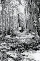
For over a century, traders and explorers travelling to the far North-West crossed Portage la Loche, linking the Churchill and Athabasca River drainage systems in northwestern Saskatchewan. The English called it Methy Portage, anglicized from the Cree mathay for “mariah fish.” To the Denesuline it was hoteth choghe, the “big portage.” The portage was already well established when Peter Pond was taken across it in 1778, the first known European trader to reach the Athabasca. Traders, including Henry the Elder, had learned of it from Denesuline and Cree as they established posts along the upper Churchill River as far as Ile-à-la-Crosse. The 19 km-long level portage is easy walking until the spectacular, steep, 180-metre descent into the Clearwater River valley. Because of the strenuous climb, brigades bringing furs from the north went only 2 km south along the portage to tiny Rendezvous Lake, where they exchanged their loads with brigades bringing goods from the south. Man-hauled carts were used by 1836, while in 1848 an unidentified “Indian” was hiring out horses. Later, by 1874, oxen were introduced which were wintered at Bull’s House on Peter Pond Lake. Then, in 1883, the portage was abandoned when steamboats began operating on the Athabasaca River, from Athabasca Landing, northeast of Edmonton. Local activity has maintained the portage, although the old cart ruts are disappearing with the use of all-terrain vehicles.
Dale Russell