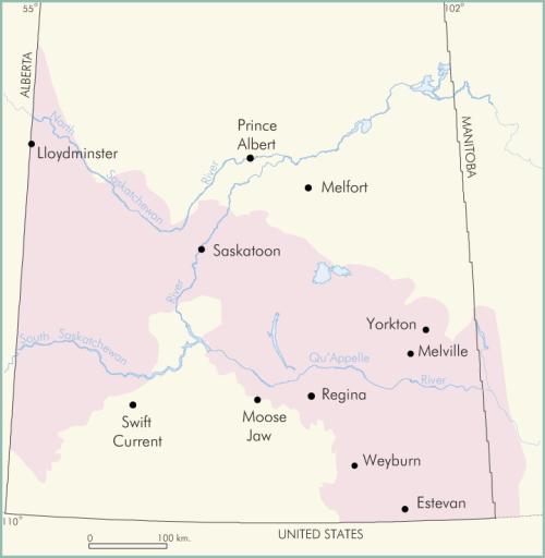
Figure EPS-1. Present extent of prairie evaporite salt in Saskatchewan and Manitoba.
The Elk Point Sea was a shallow waterway that extended southeastward from the present Northwest Territories to the Williston Basin of North Dakota, southwestern Manitoba and southeastern Saskatchewan. The inland sea persisted for much of mid-Devonian time, approximately 375 to 400 million years ago. For some millions of years the growth of organic reefs in the area from Great Slave Lake to the Yukon limited circulation into the embayment from open ocean to the northwest. The result of this restriction, along with a hot and arid climate, was that as much as 215 m of prairie evaporite—mostly halite (sodium chloride), anhydrite (calcium sulphate) and potash (mostly potassium chloride)—were precipitated ( see Figure EPS-1 above). In southern Saskatchewan four zones of potash near the top of the evaporite unit are buried to a depth of 900 m to 2750 m. Eight underground mines and two subsurface solution projects in Saskatchewan which produce from the potash zones account for a third of the world’s commercial production; in 2000, potassium chloride production approximated fourteen million tonnes, with an export value of about $1.6 billion (see mineral resources; mining).
Laurence Vigrass